Self-guided walking tour: route planning and navigation
A self guided walking tour in an old town rarely fails because the traveller chose the wrong church or missed a famous square.
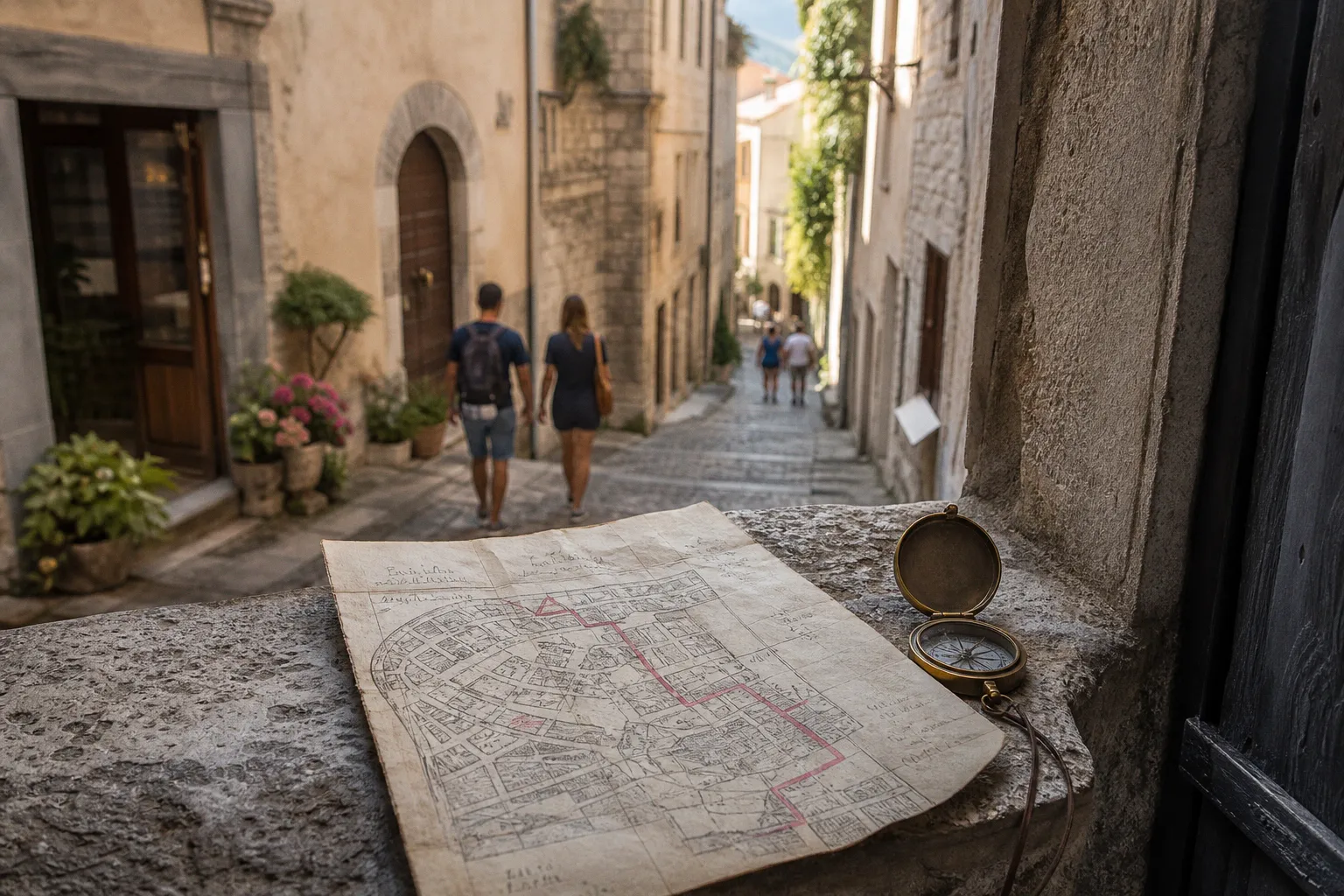
The useful measure is not how many sights can be pinned on a map. In most historic cores, a workable self guided city walk sits somewhere around 3–6 kilometres and lasts 2–4 hours, including stops. The average human walking pace may be 3–5 kilometres per hour on open pavement, but old towns slow us down in the same way traditional kitchens slow down a recipe: by adding necessary handling. We pause to read a carved lintel, cross a market square, climb a lane laid before modern gradients were anyone’s concern, and let a façade yield its date, its trade, its patron, its repair.
Mapping the historic core: density is not the same as meaning
The first temptation in old town walking route planning is to collect landmarks as if we were filling a basket at the morning market: cathedral, gate, guildhall, bridge, synagogue, market hall, monastery, fountain. The basket fills quickly. The meal may still not hold together.
A strong self guided walking tour needs a line of inquiry. In a medieval or early modern quarter, that line often follows the old logic of supply: water, grain, worship, defence, trade, craft, administration. Streets were not arranged to amuse later visitors. They carried flour to bakers, hides to tanners, fish to fasting households, timber to builders, petitions to civic offices, and bodies to burial grounds. When we map a walk by that historic function, the route begins to explain itself.
I tend to start not with the grandest building but with the old working hinge of the town. That may be a river landing, a market square, a former city gate, or a street where plots narrow into a pattern of workshops and dwellings. From there, the route should move through a sequence that makes historical sense:
1. Arrival and exchange. Begin at a gate, harbour, bridge, or station edge where goods and people entered. This gives the walk its economic footing.
2. Market and storage. Move toward the square, weigh house, granary, arcades, or covered market. Here the town’s appetite and taxation become visible.
3. Civic and sacred power. Add town hall, cathedral, parish church, law court, or bishop’s palace, but let them answer the market rather than float above it.
4. Craft and residential fabric. Include smaller streets where workshops, courtyards, fountains, and ordinary houses show how labour fitted into the plan.
5. Defence or boundary. End at a wall, bastion, river edge, or old suburb. A boundary gives the route a clean finish and reminds us that historic towns were managed spaces, not open museums.
This order is not a rule. It is a way of avoiding the “postcard scatter” that makes a walk feel busy but thin. A Roman grid town, a Hanseatic port, an Ottoman bazaar quarter, and a hilltop fortified town will each ask for a different route. The point is to identify the old pressure points: where grain was weighed, where water was fetched, where carts could turn, where soldiers could see the valley, where pilgrims entered, where merchants paid.
The old town is not a tray of monuments; it is a worked landscape of food, labour, worship, trade, and control.
For practical mapping, keep the route compact at first. A 4-kilometre line through a dense historic centre can already feel full if it includes ten meaningful stops. Add distance only when the spaces between sites are themselves instructive: a processional avenue, a workers’ quarter, a canal edge, a ring of fortifications, or a slope that explains why the castle sits where it does.
A simple route structure usually serves better than a clever one:
| Route shape | Best for | Where it can go wrong |
|---|---|---|
| Loop | Walled old towns, compact historic centres, travellers returning to the same hotel or station | Can become repetitive if it circles only major squares |
| Linear walk | River towns, port quarters, ridge settlements, pilgrimage routes | Requires clear transport or a pleasant return path |
| Figure-eight | Dense quarters with two historic cores, such as market and cathedral precincts | Needs a strong midpoint so the crossing does not feel accidental |
| Spiral inward | Hill towns, fortified centres, towns with a dominant cathedral or citadel | Can be physically demanding if elevation is ignored |
| Market-to-wall route | Towns where trade and defence shaped the plan | Works poorly if modern roads have severed the old approaches |
A good map also acknowledges appetite and fatigue. Historic exploration is not separate from the life of the town. If a route passes a market hall at closing time, a bakery only in the morning, or a fish quay after the day’s landings have gone, the timing matters. We may not be writing a food itinerary, but food infrastructure is one of the most reliable witnesses to urban history.
Navigating the urban canyon: when GPS becomes only one ingredient
Modern walking has trained us to trust the blue dot. In old towns, that trust needs seasoning with caution. Narrow medieval lanes, high masonry walls, arcades, covered passages, and dense blocks can create the familiar “urban canyon” effect, where satellite signals bounce or weaken. The phone places us one alley over, rotates the arrow, or insists we have reached a courtyard we cannot enter.
This is not a reason to reject digital navigation. It is a reason to prepare a layered method. A self guided walking tour should work even when the GPS stutters for five minutes in a lane built long before satellites were imagined.
The most reliable navigation stack for a historic quarter is modest:
- A route saved offline before arrival. Mobile signal often weakens inside thick-walled streets, underground passages, and crowded squares. An offline map prevents the small panic that leads to poor route decisions.
- A paper or static map screenshot. Not because paper is romantic, but because it shows the whole shape at once. We can see the river bend, the wall line, the slope, and the next square without being dragged turn by turn.
- Street-name awareness. In many old towns, street names preserve trades, gates, saints, markets, wells, or ethnic quarters. They are wayfinding tools and historical evidence at the same time.
- Physical landmarks. Towers, gates, bridges, fountains, and market halls anchor the route when the phone arrow jitters.
- Interpretive signage. Heritage markers, wall plaques, and municipal panels often carry the short local context that replaces a human guide at a specific point of interest.
Interpretive signage is uneven from town to town, and there is no single global standard that makes it predictable. Some cities invest in well-maintained plaques with maps, dates, and archival images. Others rely on small bronze tablets, QR codes, or faded boards placed where sunlight and rain have done their slow work. Readability matters. A minimum font size around 24pt is often cited for physical heritage signage to be comfortably legible, but many older systems fall short, especially for travellers with tired eyes at the end of a long route.
There is another practical detail: plaques are usually installed to suit civic maintenance, not the natural rhythm of a walk. A sign may face a roadway, hide beside a church door, or sit behind a café terrace. Do not let signage dictate the entire route. Use it as seasoning, not as the grain itself.
The old trick: navigate by thresholds
Old towns reveal themselves through thresholds. If GPS is uncertain, look for the urban grammar that earlier residents used daily:
- A narrowing lane often marks an older property boundary or defensive approach.
- A widening street may signal a former market function, even if modern traffic now occupies it.
- Steps, ramps, and sudden gradients often show where the town climbed from riverbank to upper precinct.
- Arcades usually indicate commercial frontage: shade, shelter, display, negotiation.
- A gate street often points directly toward a vanished wall or surviving tower.
- A church apse or tower can orient a district even when the square around it has been altered.
We navigate better when we stop treating the old town as a neutral grid. It is closer to a preserved pantry: layers of use, repair, storage, adaptation, and occasional concealment.
Digital storytelling: audio apps, municipal maps, and the discipline of not overloading the walk
The 2010s brought a marked expansion of GPS-based walking tour apps. Platforms such as VoiceMap or PocketSights made location-triggered audio a standard part of urban heritage exploration. Used well, audio can restore voices to streets that otherwise risk becoming architectural surfaces only: a merchant route, a plague boundary, a minority community, a demolished wall, a canal now paved over.
Used poorly, it can turn a walk into homework with better headphones.
A digital tour should not fill every minute. Old towns require unscripted looking: the mason’s repair in a church corner, the drain channel down the centre of a lane, the change from river stone to brick, the smell of malt from a brewery yard, the cabbage and herbs stacked in a market stall, the shadow line where a house was raised by a later floor. If the audio never stops, the town becomes a backdrop to content.
For travellers planning their own route, I would treat digital tools as three separate instruments:
| Tool | What it does well | What to watch |
|---|---|---|
| GPS audio app | Delivers story at the exact location, useful for solo travellers and complex histories | Can misfire in narrow lanes; may over-narrate and reduce observation |
| Official municipal heritage map | Usually reliable for listed monuments, museums, trails, and public access | May prioritise civic branding over difficult histories |
| General navigation app | Efficient for distances, opening hours, and transport links | Often misses pedestrian nuance: steps, cobbles, private passages, seasonal closures |
The best DIY historic walking tour usually combines official information with independent observation. Municipal routes are helpful because they know which courtyards are open, which walls are publicly accessible, and where the town has placed its interpretive panels. But official routes sometimes smooth the story. They may celebrate guild wealth without saying who tanned the hides, hauled the timber, cleaned the fish, laundered linen, or lived outside the wall when status and sanitation demanded distance.
That omission matters. Heritage walking is not only the appreciation of carved stone. It is the study of how a place fed, housed, taxed, defended, and disciplined its people. We owe the old streets that fuller reading.
A self-guided route earns its keep when it lets the famous buildings speak, then asks who supplied the lime, the bread, the wool, the labour, and the rent.
For audio use, I suggest a simple rhythm: listen before the stop or just after arriving, then remove one earbud and look. If we are standing in a square, we should hear the square — delivery carts, bells, gulls in port towns, tram brakes beyond the pedestrian zone, café chairs being stacked, the rinsing of crates at market close. Sound is evidence too.
Pacing the walk: distance, stops, and the honest work of feet
The published distance of a walk can mislead. Three kilometres on a riverside promenade is not the same as three kilometres through a hill town with limestone steps, polished cobbles, and ten architectural stops. A comfortable walking pace of 3–5 kilometres per hour belongs to open movement. In a historic district, every pause changes the calculation.
For most old town itineraries, the better unit is not distance but attention. After two hours, even serious travellers begin to read less carefully. After three hours, small details blur unless there has been a proper pause. After four hours, the walk needs either a meal, a museum interval, or a very strong reason to continue.
A workable pacing model looks like this:
1. Limit the core route to 8–12 stops. More than that, and the walk becomes a list. If a town is exceptionally rich, build two walks rather than one swollen route.
2. Place major stops 5–12 minutes apart. Shorter intervals create a stuttering rhythm; longer intervals work only if the streets between them carry visible history.
3. Schedule one real pause. A market hall, cloister courtyard, riverside bench, public garden, or café terrace can reset attention. The pause should be part of the geography, not an apology for poor planning.
4. Account for surfaces. Cobblestones, setts, brick, wet stone, steep steps, and uneven paving slow the body. They are historically meaningful, but they are still hard underfoot.
5. End somewhere with choices. A station, taxi rank, tram stop, restaurant street, or waterfront gives the walker options. Ending at an isolated viewpoint may be dramatic and impractical.
I am wary of itineraries that promise “all the old town in two hours.” They often reduce the place to façades and dates. A better two-hour route can be excellent if it is honest: one district, one historical question, one compact sequence. The shorter walk should be sharper, not merely faster.
Time of day also changes the route. Early morning reveals supply chains: bakers receiving flour, vendors setting herbs and root vegetables on stalls, fishmongers washing trays, delivery vans testing the tolerance of pedestrian streets. Midday gives open churches and municipal interiors. Late afternoon is kinder to façades and photographs but may close markets and smaller museums. Evening can make defensive walls and riverfronts legible, though signage becomes harder to read.
Season matters as well. In summer, shade determines comfort in stone-built quarters. In winter, a cobbled lane can become slick, and daylight fades before the route has finished. Spring markets bring greens, flowers, lamb, and young cheeses in agricultural regions; autumn may show mushrooms, apples, chestnuts, wine harvest traffic, or preserved foods returning to household rhythms. These are not decorative details. They connect the historic centre to its rural hinterland, the same relationship that built much of the town’s wealth.
Pedestrian zones and the modern old town: useful, but not neutral
Many European Altstadt districts are now high-density pedestrian zones where walking is the primary mode of transport, with vehicle access restricted to residents, deliveries, emergency services, and municipal maintenance. This shift, closely associated with pedestrianisation movements that gathered force in the 1970s, has made historic centres more walkable and less exhaust-stained. It has also changed how we experience them.
A pedestrian zone is not automatically a preserved old town. It can protect the fabric while also encouraging a narrow visitor economy: souvenir shops, short-let apartments, simplified menus, polished squares emptied of ordinary services. For route planning, the question is not only “Can we walk here?” but “What kind of life does the walk reveal?”
A good self guided walking tour should step slightly beyond the most manicured pedestrian spine when possible. One street behind the cathedral route we may find the locksmith, the school entrance, the vegetable seller, the repair scaffold, the municipal noticeboard, the butcher still receiving local pork rather than anonymous shrink-wrapped cuts. These places keep the historic centre from becoming a stage set.
At the same time, modern pedestrian planning can help us read the old town safely. Car-free streets allow slower looking. Former tramlines, bollards, delivery windows, paving changes, and access controls show how the city negotiates between preservation and daily use. A morning delivery van in a restricted lane may look like an intrusion, but it is part of the living supply chain: bread, linens, beer barrels, vegetables, cleaning materials, museum equipment. Historic quarters cannot survive on atmosphere alone.
There is also a small discipline in respecting local movement. Residents know the shortcuts, the delivery hours, the school rush, the church funeral, the market queue. A visitor following a phone should not block a narrow passage to reorient. Step into a doorway recess or square edge, let people pass, then consult the map. This is not etiquette as ornament; it is how dense old places continue to function.
Accessibility realities: cobbles, inclines, steps, and what honest planning requires
It is easy, and inaccurate, to describe an old town as “walkable” without saying for whom. Many historic districts were built with steep gradients, narrow pavements, drainage channels, steps, thresholds, and cobbled surfaces. Some have been carefully adapted with ramps, smoother strips, lifts, and accessible museum entrances. Others remain difficult for wheelchair users, travellers with limited mobility, parents pushing strollers, or anyone managing fatigue, pain, or visual impairment.
We should not pretend that all historic old towns are fully accessible. We should also not assume they are impossible. The responsible approach is to plan with surface, slope, rest, and exits in mind.
For a more accessible self guided city tour, consider these route decisions:
- Choose fewer stops with better approaches. A route with six reachable sites is stronger than one with twelve that repeatedly force difficult detours.
- Favour lower-town routes where terrain allows. Riverfronts, market quarters, and former commercial streets often have gentler grades than castle or citadel approaches.
- Check whether “pedestrian” means smooth. A car-free lane may still be uneven, steep, or interrupted by steps.
- Use official accessibility information, but verify recent conditions. Repairs, scaffolding, festival barriers, and seasonal closures can change a route overnight.
- Build in seated pauses. Benches, cloisters, church porches, museum foyers, and public gardens are not luxuries when the paving is hard.
- Identify exit points. Tram stops, taxi stands, bus routes, and level return paths should be marked before starting, not discovered after exhaustion sets in.
The same advice applies in a different way to travellers who are fit but unfamiliar with old surfaces. Wet cobbles can be treacherous. Polished stone steps outside churches are often worn by centuries of feet. In warm climates, pale paving reflects heat; in northern towns, shade and damp linger in narrow lanes. Shoes matter. So does humility.
A historic walking itinerary should never make physical strain the proof of seriousness. The labour we are there to understand — quarrying, hauling, building, baking, brewing, washing, carrying, selling — was real enough. We do not honour it by turning a day’s exploration into avoidable discomfort.
Building the route: a practical method that still leaves room for discovery
When planning a self guided walking tour before arrival, I use a method closer to sourcing ingredients than assembling a sightseeing list. First, identify what is essential and local. Then decide what can be left out without damaging the character of the whole.
Start with a base map and mark no more than fifteen possible sites. Then reduce. Ask what each stop contributes. If three churches tell the same story of patronage and rebuilding, choose the one that sits best in the route or reveals the most distinct craft. If two squares both functioned as markets, use the one where trade geography remains visible. If a famous monument sits far outside the historic thread, save it for another walk unless the route to it explains something.
A good planning sequence might run as follows:
1. Define the historical question. Examples: How did this port feed itself? How did the wall shape trade? Where did civic power sit in relation to the cathedral? How did water determine the quarter?
2. Mark the anchors. Choose three to five unavoidable places: gate, market, church, town hall, bridge, wall, harbour, or craft street.
3. Connect by meaningful streets. Avoid defaulting to the fastest route. Select streets with visible plot patterns, arcades, workshops, old signage, or changes in elevation.
4. Test the distance. Keep most routes between 3 and 6 kilometres unless there is a strong reason and a clear rest plan.
5. Add interpretive layers. Use municipal plaques, museum exterior panels, audio segments, and architectural observation, but do not overload each stop.
6. Plan food and rest with historical sense. A market pause, bakery street, old brewery district, or riverside fish quarter can deepen the walk rather than merely feed the walker.
7. Prepare a fallback. Weather, closures, festivals, and roadworks are part of old-town travel. Know which stop can be skipped without collapsing the route.
There is no shame in leaving things out. Traditional foodways teach this plainly: a stew is not improved by emptying the whole pantry into the pot. A walking route gains flavour from restraint. The omitted museum, the unvisited tower, the second cloister — these are reasons to return, not failures of planning.
Reading as you walk: architecture, markets, and the small evidence of use
Once the route begins, the best self guided city tour tips are less about technology and more about attention. Old towns reward the walker who looks at ground level as well as upward. Grand façades tell one story; thresholds, gutters, shopfront depths, hoist beams, cellar doors, and worn steps tell another.
Look for the working evidence:
- Market architecture. Arcades, covered halls, broad squares, weighing houses, and fountain placement show where goods were displayed, washed, taxed, and sold.
- Water systems. Wells, conduits, public fountains, channels, and river steps reveal the daily labour behind cooking, brewing, dyeing, tanning, and cleaning.
- Plot widths. Narrow frontages often indicate taxation, inheritance patterns, or dense commercial use.
- Upper-storey changes. Timber frames, later brick skins, added floors, and repaired cornices show prosperity, regulation, fire risk, and fashion.
- Back lanes and service entries. These can say more about labour than the ceremonial square.
- Street names. Bakers’ Street, Fishmarket, Tanner Lane, Salt Gate, Wool Street: names often preserve the economic map after the trade itself has moved.
Food history is especially useful because it resists abstraction. A city that imported salt had different possibilities for curing fish and meat. A town with reliable grain storage could withstand shortages better than one dependent on daily cart traffic. A monastery with fishponds, vineyards, orchards, or herb gardens shaped both diet and land use. A port’s spice trade might appear in elite kitchens long before ordinary households tasted the same goods. Walking with these questions keeps the route grounded in material life.
We should also watch for absence. Where are the workers’ houses? Where was waste sent? Which trades were pushed downstream because they smelled or polluted water? Which communities lived outside the main gate? Historic itineraries become more honest when they include the less polished edges of prosperity.
The final measure: a route that can be remembered
A good self guided walking tour does not need to be exhaustive. It needs to be coherent enough that, later, the town can be remembered as a set of relationships rather than a blur of façades. We should be able to say: the gate fed the market; the market financed the guildhall; the church governed the skyline; the river carried timber and fish; the wall narrowed the streets; the hill protected the citadel and punished the knees.
Technology can help. Interpretive signage can help. A well-drawn municipal map can help. But the real craft lies in choosing a route that respects historical density, bodily limits, local labour, and the imperfect texture of old streets. Walk slowly enough to let the place disclose its workings, and plan firmly enough that curiosity has room to wander without getting lost.