London self-guided walking tours: the digital evolution
A “self guided walking tour London” search now promises a private historian in your pocket, a perfectly timed route and, frequently, the implication that the city will reveal itself without friction. The reality is more prosaic.
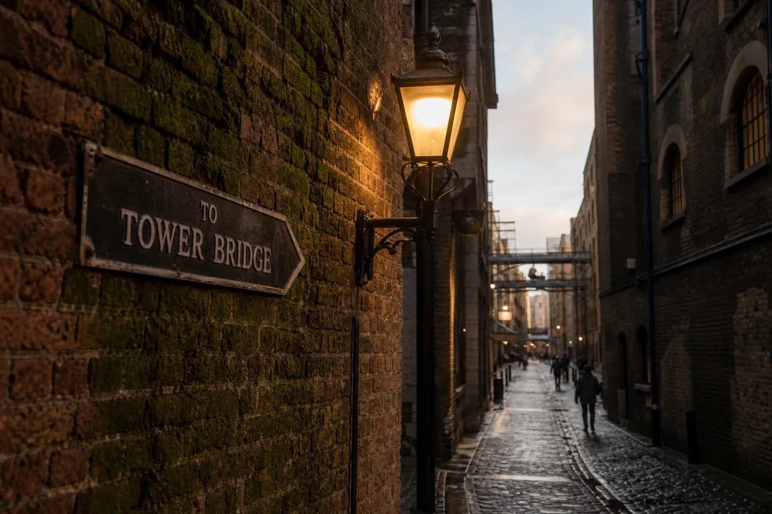
London’s historic core is an uneven pavement of closed churchyards, railway cuttings, construction hoardings, tunnelled stations and GPS signals that can bounce between tall façades with all the confidence of a badly briefed concierge.
Yet the digital shift is real. The paper walking leaflet—with its tiny numbered dots, optimistic timings and inevitable rain-softened folds—has been overtaken by apps that know where the walker is, trigger narration at the right corner and, in some cases, invent an itinerary in half a minute. This is useful. It is not automatically good.
I have tested enough heritage routes to distrust the phrase “immersive experience” on sight. A route succeeds not because it places a glowing pin over a Tudor doorway, but because it understands the physical city: where a pedestrian can actually stand, which view has survived, which lane is a delivery corridor at noon, and when a story needs silence rather than another chirpy audio clip.
From paper maps to GPS-triggered narratives
London has always suited the self-directed walker, although it has rarely made the task easy. A medieval street pattern meets nineteenth-century infrastructure and twenty-first-century crowd management. A line that appears simple on a map may involve three crossings, two flights of steps and a pavement narrowed to the width of a suitcase wheel.
The digital self-guided city walk addresses part of that problem very well. VoiceMap, for example, has more than 100 self-guided audio tours in London. Its GPS autoplay can trigger audio when the walker reaches a location, with positioning stated at roughly 5 to 15 metres. In an open square, that can feel remarkably smooth: turn a corner, hear the story, look up, and the architectural detail is there.
In the City of London, that matters. A conventional printed itinerary might tell a visitor to “continue to St Mary-le-Bow” and leave them to decode a knot of lanes around Cheapside. GPS-triggered narration can instead guide them through the approach and reserve the history until they are within sight of Wren’s tower. The improvement is not glamorous. It is simply competent wayfinding, which heritage tourism has too often treated as beneath its dignity.
However, the technology also exposes a common weakness in digital tour design: location is not interpretation. Audio that begins at the correct coordinates can still describe the wrong visual field. On a busy pavement, the listener may be facing a Pret, a bus queue or the back of another visitor’s head while being invited to admire a façade across six lanes of traffic. The app has fulfilled its technical brief; the route has failed its editorial one.
GPS can tell a tour where the walker stands. It cannot tell it whether the walker can see anything worth hearing about.
GPSmyCity takes a more traditional approach: a catalogue of pre-set walks, including areas such as Covent Garden and historic pub routes. It offers roughly 16 to 18 London walks. The basic app is free, whereas GPS-positioned maps and voice-guided directions sit behind paid access, either per tour or through an annual subscription beginning at $14.99.
That is a defensible commercial model, despite the habitual outrage whenever a digital map asks to be paid for. Research, recording, editing and maintaining routes through a city of permanent disruption cost money. What I object to is the veneer of a free guide that becomes navigable only after payment. A heritage walk should state, before download, whether the route map works offline, whether turn-by-turn navigation is included, and whether audio is a teaser or the actual product.
What a well-built digital route does differently
The strongest London historic walking routes use the phone to reduce administrative burden, not to turn every paving stone into a notification. In practical terms, they tend to do four things:
1. They establish a clear walking logic. A good route moves with the grain of the quarter: river to market, gate to church, court to alley. It does not zigzag solely because a database contains another point of interest 120 metres away.
2. They distinguish landmarks from stopping places. A landmark may be visible from a distance; a stopping place must be somewhere a walker can safely pause without blocking a pavement or being drowned out by traffic.
3. They give usable time estimates. “One hour” can mean 45 minutes of brisk transit or two hours of reading façades, visiting churches and detouring for coffee. Those are different products with very different occupancy in the day.
4. They acknowledge closure and access limits. London’s heritage is not a museum set. Church interiors close, livery halls are private, courts may be gated, and station exits are rebuilt. A route that pretends otherwise is not romantic; it is unfinished.
For a DIY walking tour London visitors build themselves, these principles remain more valuable than the app brand. The phone is an instrument, not an authority.
The rise of AI-generated heritage itineraries
The newest proposition is not a curated route but an instant one. London-founded startup iWander, established in 2024, says it can generate a custom audio walking tour for any city or neighbourhood in 30 seconds. Its subscriptions start from $10 per month.
That speed is genuinely attractive. Ask for “Georgian Bloomsbury, two hours, no museums, finish near King’s Cross” and an AI system can produce a route faster than a human guide can locate a pencil. It can also adapt the basic footprint: wheelchair-friendly preferences, a shorter window before a theatre matinee, a desire for literary history rather than royal spectacle.
But speed is not scholarship. Nor is personalisation necessarily curation.
London is particularly awkward terrain for generative itinerary tools because the historic city is full of plausible-but-misleading connections. A model can identify a building, a date and a famous former resident. It may be less reliable at deciding whether the building is visible from the street, whether the attribution is contested, whether a blue plaque has moved, or whether the suggested “quiet lane” is now a construction access route.
The distinction is not academic. Heritage walking is an exercise in trust. Once an app confidently misidentifies a church, invents a view or directs visitors through a locked passage, its polished audio voice becomes a liability.
| Route type | What it does well | Where it commonly fails | Best use |
|---|---|---|---|
| Curated GPS audio tour | Strong narrative sequence; location-triggered commentary; repeatable route | Can become rigid, dated or overproduced | First visit to a historic quarter |
| Pre-set map itinerary | Clear structure and predictable duration | Often lacks context at the moment it is needed | Walkers who prefer reading and independent pacing |
| AI-generated route | Fast tailoring by interest, time and neighbourhood | Variable historical accuracy and weak on practical access | A starting draft, checked against reliable sources |
| Human-led walk | Live questions, route adjustments and interpretation | Fixed departure times; group pace; variable guide quality | Complex subjects or visitors wanting discussion |
I would use an AI route as a reconnaissance tool, not as the sole historical authority. Ask it for a shape, then interrogate it. Does it explain why these streets belong together? Does it take you past the relevant buildings rather than merely nearby? Has it confused a surviving fragment with a complete site? If the answer is a stream of smooth but generic prose, abandon it before it sends you on an urban hike through the back of a shopping centre.
A better use of AI is narrow and practical: rebuilding a route after rain, shortening a walk because a child has reached architectural saturation, or connecting two confirmed heritage sites without resorting to a taxi. It can be excellent at logistics. It should not be allowed to manufacture certainty.
Immersive layers: AR, games and the problem of looking at a screen
Augmented reality is the next layer of the sales pitch. London’s AR Trail for the Heritage Quarter, developed by Zubr, covers 11 notable sites through interactive games, challenges and digital collectibles. Such trails are designed to turn passive sightseeing into participation, which is a reasonable ambition in a city where younger walkers have been handed too many plaques and too little explanation.
The best AR use is reconstructive. A lost gateway, demolished building line or vanished industrial edge can be difficult to grasp from a surviving wall and a paragraph of text. A carefully made digital overlay can restore scale and orientation. It answers the question heritage interpretation should always answer: what, precisely, am I looking at—and what has gone?
The worst use is decorative. I have seen enough historic environments burdened with cartoon arrows, collectible badges and digital confetti to know that “engagement” can become an excuse for refusing to explain anything. A sixteenth-century street does not need to impersonate a mobile game in order to retain attention. It needs a story with stakes, an intelligible map and enough space for the walker to notice the actual materials: brick, soot, Portland stone, patched timber, later retrofit.
AR also has a physical cost. London walking routes frequently pass through crowded spaces where holding a phone at chest height is less an interpretive act than a collision risk. The old town is already there. Looking at it through a screen should be optional, brief and justified.
Digital interpretation earns its place when it reveals what the street cannot show on its own—not when it competes with the street for attention.
For cultural sites, the more restrained digital guide is often the better one. Bloomberg Connects, a free app, hosts guides for major London institutions and routes, including the Old Royal Naval College. Its guide spans 600 years of history and is available in more than 40 languages. That multilingual reach is not a fashionable add-on. It is basic hospitality, especially at sites whose history is routinely presented as if English were the only language through which it can be understood.
The app also includes Open City’s The Walls of London walking tour. This is exactly the kind of subject that benefits from digital support: the Roman and medieval wall survives in fragments, absorbed into gardens, office developments, underground spaces and street edges. A good guide can connect those pieces without pretending that the modern city politely preserved the whole perimeter for visitor convenience.
London Unseen and the value of a route with an argument
The most interesting development is not technical at all. It is the rise of community-led heritage routes that challenge the standard London inventory of palaces, plague markers and famous dead men.
The London Unseen programme, supported by the Mayor of London, offers mobile-accessible self-guided walks including a Queer Soho tour and a Muslim Heritage Trail. These routes are paired with focused podcasts of around six minutes. That duration is shrewd. Six minutes can frame a place without forcing the walker into the peculiar modern ritual of standing outside a building while an app delivers an entire lecture at them.
The significance lies in editorial choice. Traditional historic walks often treat London as a procession of official power: monarchs, architects, financiers, military figures, institutional façades. Those subjects deserve attention, but they are only one footprint in the city. A route through queer Soho or Muslim London changes the map’s centre of gravity. It asks whose histories have been preserved in stone, whose survive in businesses and social spaces, and whose were pushed out of the official record.
This is where a self-guided route can be more candid than a generic group tour. A human guide has many virtues, but group walking has constraints: pace, audibility, time, the economics of keeping 20 people together near a road crossing. A digital route can allow a visitor to linger outside a former meeting place, replay an account, take a detour, or stop entirely. It offers privacy as well as autonomy.
Still, community-led does not mean exempt from scrutiny. A route should identify its sources where appropriate, distinguish testimony from settled fact, and avoid converting difficult histories into a brisk sequence of branded “discoveries.” The ethical standard is not whether a story feels fresh. It is whether the route treats the people in it as more than content.
Practical navigation for offline heritage exploration
The unglamorous feature that matters most is offline access. VoiceMap, GPSmyCity, iWander and Rick Steves Audio Europe all support offline modes, allowing users to download maps and audio before setting out. In a city with patchy underground connectivity and expensive data roaming for some overseas visitors, this is not a luxury feature.
It is also a test of whether an app respects the walker. A tour that requires a live signal at every junction has mistaken London for a showroom. There are stretches of the Thames path, station underpasses, dense City streets and museum interiors where connections are unreliable. Battery drain is another matter routinely ignored by app marketing, despite the fact that constant GPS, audio and screen use can turn a full charge into a nervous calculation by mid-afternoon.
Before relying on any self-guided heritage trail, I make a small but consequential preparation:
- Download the complete route, audio and map over Wi-Fi, then open the app in airplane mode to verify that it actually works.
- Save the route endpoint separately in a general mapping app. A tour may know its own stops perfectly while being remarkably vague about the nearest station or bus.
- Carry a power bank on long routes, particularly if using AR or continuous GPS tracking.
- Read the first two and final two stops before leaving. This reveals whether the route has a coherent beginning and ending, or merely a list of pins with an inflated narrative.
- Check opening hours for any interior that is central to the route. A street-based walk can survive a closure; a church-and-courtyard itinerary cannot.
- Keep one analogue reference: a screenshot, a downloaded area map or even a written street name. This is not nostalgia. It is redundancy.
There is a further practical point. The best time for a historic walk is not always the time an app suggests. Covent Garden is physically easier in the early morning; the City of London is often calmer at weekends but can feel oddly vacant; Soho is better read as a lived quarter later in the day, although its pavements become less forgiving. A route’s stated duration is merely its baseline. Weather, crowd density and the walker’s curiosity determine the actual timetable.
The digital guide is useful. It is not the destination.
The evolution from paper maps to GPS narration, AI-generated routes and AR overlays has made London more accessible to independent walkers. It has also made it easier to confuse access with understanding.
A competent self guided walking tour London experience should reduce navigational friction, provide reliable historical context and leave enough silence for the quarter to register on its own terms. It should not make extravagant claims about “hidden gems” that turn out to be visible from a bus, nor bury a usable map beneath subscriptions and “bespoke” language.
I remain fond of the old paper map, partly because it forces a walker to understand the city’s shape. But I would not romanticise its shortcomings. Digital tools can be more precise, more inclusive and far better at guiding someone through London’s complicated historic fabric.
The sensible approach is neither nostalgia nor surrender to the algorithm. Download the route. Test it offline. Treat AI as a drafting assistant, not a historian. And when the phone tells you to stop, look up before it begins talking.