Venice self-guided walking tours: from paper to GPS
A Venice walking tour app will promise a clean blue line from one “hidden gem” to the next. The city, however, was built on more than 100 small islands, stitched together by bridges, passages and centuries of practical improvisation.
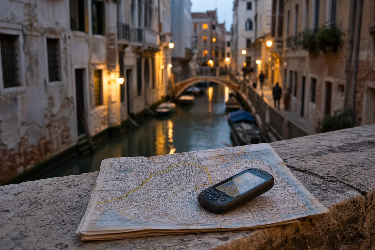
A route that looks like a modest 1.8-kilometre stroll on a screen can become a sequence of reversals, dead-end fondamenta and increasingly expensive decisions made near a café.
I have inspected enough historic quarters to distrust any navigation product that calls itself seamless. In Venice, the issue is not that GPS is useless. It works reasonably well in broad spaces such as Piazza San Marco and along the Grand Canal. The issue is that an app designed for ordinary streets meets a city that has never had much use for ordinary streets. Stone walls squeeze the sky into a narrow strip; water reflects signals; house numbers ignore the street-based logic visitors expect. The result is not catastrophe, usually. It is attrition: five minutes lost here, a bridge missed there, a route that deposits you at a canal with no crossing in sight.
A good self guided walking tour Venice plan therefore needs a less glamorous proposition than “download and go.” Use the phone, certainly. But pair it with a paper map, learn the yellow signs, and treat a route as an argument with the city rather than a contract signed by software.
In Venice, the most dependable navigation system is often the one bolted to a wall, not the one recalculating in your hand.
The digital paradox: GPS is useful until the walls close in
Venice’s calli are not simply narrow lanes marketed as quaint. They are physical constraints. High masonry walls stand close together, buildings overlap at awkward angles, and the network repeatedly passes beneath covered passageways known as sottoporteghe. GPS depends on a clear conversation with satellites; Venetian urban fabric has spent centuries interrupting conversations.
I see the familiar symptoms on nearly every self-guided route: the blue marker turns slowly in the wrong direction, then jumps across a canal; the route redraws itself just as the walker reaches a fork; an instruction to “continue straight” becomes meaningless because “straight” ends at water. This is signal drift, not visitor incompetence. The city’s hard stone surfaces and water corridors can scatter and distort the information a phone is trying to interpret.
The standard global map apps remain useful for orientation, opening hours, saved places and the broad shape of a district. They are less persuasive when they pretend to know every pedestrian decision inside the maze. One recurring flaw is routing a visitor toward an apparent crossing where no bridge exists. Another is proposing a gondola or traghetto crossing as if it were a normal pavement link. That may be charming in theory; in practice, it is an interruption with operating hours, a queue, and occasionally a price that does not belong in a supposedly free walk.
Before setting out, I would make three modest adjustments:
1. Download the relevant map area for offline use. This does not cure GPS drift, whereas it does prevent a weak data connection from turning a navigational wobble into a blank screen. Venice is not the place to discover that your route depended on continuous roaming.
2. Set pedestrian preferences with suspicion. If the app permits an “avoid ferries” option, use it for a continuous walking route. A traghetto can be a useful experience when chosen deliberately; it is poor emergency infrastructure when an algorithm has quietly made it essential to the next instruction.
3. Save destinations by name as well as address. A restaurant, church or hotel name is more durable than a pin that has begun wandering. If you have to ask a local for direction, “Campo Santa Maria Formosa” is far more useful than “my phone says I’m 300 metres away.”
The fashionable veneer here is the idea that better software abolishes local geography. It does not. Venice is not a failed grid. It is a medieval and early modern city whose circulation system was arranged around canals, parish spaces, trade, foot traffic and a dense building footprint. A digital map can represent that system. It cannot simplify it without losing something material.
The house number is not the address you think it is
The second trap in a Venice self guided itinerary is the house number. Visitors used to London, New York or almost any conventional European city assume that numbers progress along a street: 18, 20, 22, and so forth. Venice uses a different logic. Numbers are assigned within each sestiere—the city’s six historic districts—and follow a sequence linked to the order of construction rather than the line of a single street.
This is why a door marked 20 can sit unhelpfully near one marked 620. Neither number is necessarily wrong. The expectation is wrong.
The six sestieri are Cannaregio, Castello, Dorsoduro, San Marco, San Polo and Santa Croce. An address is incomplete without its district. “Calle Something, 4023” may look admirably exact on a hotel confirmation; without “San Marco” or “Cannaregio,” it has the navigational elegance of a suitcase tag with no city on it.
This numbering system is often treated as a colourful eccentricity, as though it exists to test tourists before lunch. It is more usefully understood as part of Venice’s historical operating system. Streets were not the primary unit of urban order in the way they became elsewhere. The sestiere mattered; parish geography mattered; waterways mattered. Modern address search can work with that system, but it cannot make the system behave like a suburban avenue.
| Navigation problem | What the visitor expects | What Venice actually does | Better response |
|---|---|---|---|
| House numbering | Numbers rise neatly along one street | Numbers can jump dramatically within a sestiere | Confirm the district, landmark and nearest campo |
| Route to a destination | A continuous street path | Canals divide apparently adjacent buildings | Identify the bridge before committing to a detour |
| GPS position | The marker shows exact facing direction | Marker may rotate or drift in narrow calli | Use the map’s shape and landmarks, not the arrow alone |
| “Nearest” destination | Short distance equals quick arrival | A canal or missing bridge can extend the walk | Read the route as crossings, not metres |
| Water crossing | A bridge is implied | The app may suggest a ferry or traghetto | Choose water crossings deliberately and check settings |
I would add one less technical point. Do not plan a route around a list of full addresses alone. Build it around anchors: the Rialto, the Ferrovia station, Piazzale Roma, San Marco, the Accademia bridge, a known campo, a major church. A hotel may occupy a restored 16th-century palazzo; its booking page may advertise “steps from Rialto”; its actual entrance may be on a narrow canal-side lane with a sign at shoulder height. The claim is not always false. It is simply written from the perspective of a marketing department, which rarely carries luggage.
Yellow signs: Venice’s low-tech navigation infrastructure
The yellow directional signs mounted at key intersections are not decorative heritage furniture. They are the city’s practical wayfinding network, and they are remarkably good at their job.
Look for signs directing you toward major anchors: San Marco, Rialto, Ferrovia and Piazzale Roma. They recur across the six sestieri, often at the moment a visitor’s phone begins offering the least convincing advice. Follow one long enough and it gives you a stable direction of travel through lanes that otherwise appear interchangeable.
The signs do not promise bespoke discovery. They do something more valuable: they get you out. That matters after 5pm, when a leisurely route has acquired baggage, fading light, restaurant reservations and the sudden realisation that the vaporetto stop is not where the app’s floating dot implied.
The limitation is equally clear. Yellow signs point to major destinations, not necessarily to your small hotel, a specific artisan workshop or the obscure church that a walking tour app has selected for a baroque ceiling. This is why the sensible method is hybrid rather than ideological.
My working hierarchy for navigating Venice on foot
When I audit a heritage stay or test a historic walking route, I use navigation sources in a strict order:
- First, establish the district and the nearest major anchor. If I am in Cannaregio, I want to know whether my destination lies toward the station, the Fondamente Nove, Strada Nova or the northern lagoon edge. This gives the walk an actual spatial logic.
- Second, use yellow signs to maintain direction across the city. They are particularly effective for a cross-city transfer: station to San Marco, Rialto to Piazzale Roma, or a recovery walk after a wrong turn.
- Third, use a digital map for the final approach. The last 150 to 300 metres are where an app can earn its battery consumption: finding the correct calle, entrance or bridge. Do not let it dictate the entire walk if its position marker has started performing.
- Fourth, carry a fold-out paper map. Yes, paper. It has no live traffic layer and cannot reassure you with a cheerful arrival time. It does show canals, bridges, districts and the relationship between places without constantly reorienting itself.
- Finally, ask a specific question. “Is this the way to Rialto?” is answerable. “Where am I?” is a cry for help, not a question. Venetians and shopkeepers can often redirect a lost visitor efficiently if given a landmark or district.
A printed Venice walking route map is especially valuable because it provides the overview a phone tends to conceal. On a small screen, two points divided by water can look absurdly close. On paper, the bridge dependency is obvious. A map also shows when a detour will lead you through a district worth seeing rather than back along the same commercial corridor.
The blue dot tells you where it believes you are. The yellow sign tells you which way the city actually connects.
From de’ Barbari’s Venice to the specialist app
There is a pleasing historical irony in Venice’s mapping problem. Between 1480 and 1570, the city was Europe’s dominant centre of printed map production. Venice was not merely selling maps; it was helping to define how Europe saw places at scale.
Jacopo de’ Barbari’s celebrated bird’s-eye view of Venice, published in 1500, remains extraordinary precisely because it makes the dense city legible without pretending it is simple. Its achievement is not a straight-line route from one attraction to another. It is the rendering of an urban organism: canal, church, roofline, quay, bridge, courtyard, warehouse and campanile in relationship.
The modern equivalent is not necessarily the largest global navigation platform. Specialist tools such as VeniceXplorer are recommended because they concentrate on pedestrian reality: sottoporteghe, passages and the peculiarities of the city’s walkable network. Transit apps such as Moovit can be useful for accurate vaporetto schedules, which matters when a walking route is sensibly broken by water rather than heroically extended around it.
There are also guided-story apps, including Questo and UCPlaces, which turn a route into a sequence of prompts, historical notes or small challenges. Their typical walks range from about 0.6 kilometres to 5.2 kilometres and commonly take one to three hours. That range is not a minor product detail. It tells you how to choose an itinerary without wrecking the rest of the day.
A 0.6-kilometre route can be ideal in San Marco if the purpose is a focused architectural circuit through densely layered streets. A 5.2-kilometre route across several districts may be perfectly reasonable in cool weather with light luggage, whereas it is a poor proposition after arrival from the airport, during high water conditions, or when the group includes anyone whose definition of “walkable” does not include repeated bridge steps.
No app, however local its mapping, removes the need for judgment. The phrase “self-guided” should mean independently navigated, not obediently shepherded by a screen. If an itinerary pulls you off a compelling campo because the next audio point is 90 seconds away, ignore it. The city has already supplied the content.
Planning a route by friction, not just distance
Most poor Venice itineraries make a basic operational error: they calculate distance but not friction. In an ordinary city, two kilometres may be an uncomplicated 25-minute walk. In Venice, two kilometres can involve crowded pinch points, stairs at bridge after bridge, a search for the correct crossing, a pause for a boat delivery blocking a lane, and a detour made inevitable by a canal.
For exploring Venice on foot, I plan in blocks rather than trying to “cover” the city. The word cover is a warning sign. It tends to produce tours that treat historic quarters as a checklist of façades, with the traveller moving too quickly to notice the ordinary urban fabric that makes Venice worth walking.
A practical one-to-three-hour format can be built around a single dominant character of the city:
A mercantile spine: Ferrovia to Rialto
Start near the station and use the routes toward Rialto as an introduction to Venice’s public circulation. This is not the quietest route, and no sensible inspector would market it as such. It is useful because it teaches the city’s scale, crowd patterns and commercial density early. Once at Rialto, leave the obvious flow and use the surrounding lanes to understand how close trade, residence and water logistics remain.
A civic and ceremonial route: Rialto to San Marco
This is the route visitors often take by instinct, and its centrality makes it both unavoidable and mishandled. Do not rush it. Use the yellow signs as a directional safety net, but permit detours through smaller squares and less polished streets. The retail frontage may be aggressive; behind it, the town plan still holds church complexes, water entrances and service alleys that explain the place better than souvenir windows do.
A quieter district walk: Cannaregio or Castello
For a Venice self guided itinerary that does not rely on headline monuments, choose one district and work slowly. Cannaregio offers a more residential rhythm away from the main transit corridors. Castello rewards patient wandering, particularly when you stop treating every deviation as a mistake. In both districts, a paper map is more valuable than an app-led tour trying to optimise every turn.
An art-and-water route: Dorsoduro
Dorsoduro can be read through larger visual spaces, canalside walks and the contrast between museum destinations and ordinary lanes. It is often easier to orient yourself here than in the tightest central passages, although “easier” is not the same as frictionless. Bridge choices still matter. So do vaporetto links if you intend to end the walk near another district rather than retrace the route.
The sensible rule is to allow more time than the app projects. Not because Venice demands reverence at every corner—some corners are merely damp service entrances—but because unplanned pauses are part of the value. A delivery boat unloading crates, laundry across a narrow canal, a parish church open for an hour, a view suddenly released after twenty minutes of walls: these are not route failures.
The hotel problem: arrival routes are not sightseeing routes
Heritage accommodation has a particular talent for using distance as a flexible concept. “Five minutes from San Marco” may be broadly accurate for a person who knows the right alley, travels without bags and is not arriving during a peak pedestrian crush. For a first-time guest pulling luggage over bridges, the same journey can feel materially longer.
This is where I am least impressed by the standard booking-page language. A 15th- or 16th-century building cannot be retrofitted into a contemporary hotel footprint without compromises. Plumbing runs, lifts, stairs, loading access and entrance signage are constrained by fabric that predates modern hospitality. Some properties manage these constraints honestly. Others cover them with words such as “intimate,” “authentic” and “boutique,” which can mean anything from admirable preservation to a room where two suitcases cannot pass each other.
Before you make a hotel your starting point for a walking day, establish four facts:
- Which sestiere it is in, not merely which landmark it claims to be near.
- The nearest vaporetto stop and whether the final approach includes bridge steps.
- The entrance name or landmark, since the street number may not be visible at first glance.
- Whether the property provides genuinely usable arrival directions rather than a generic map pin.
This is not a demand for luxury. It is a demand for candour. Venice’s historic fabric is the asset; it should not become an excuse for avoidable confusion. A hotel that explains its access clearly is usually better managed in other respects as well.
The route is allowed to change
The finest Venice walking tour app is still an aid, not an authority. Use it to find a church, identify a sottoportego, understand the next vaporetto connection, or retrieve a route after a deliberate diversion. Then put it away long enough to notice whether the path is actually pleasant, crowded, closed, private or simply less interesting than the turn you nearly took.
There is no contradiction between a paper map and GPS, nor between a historical route and a current transit app. Venice has always required layered systems of knowledge: waterways and landmarks, districts and parishes, trade routes and footpaths. The visitor who combines them is not travelling nostalgically. They are travelling competently.
My preference is blunt. Begin with a map large enough to show the city. Keep an offline digital map for recovery. Follow yellow signs when crossing districts. Treat house numbers as district codes rather than street sequence. And leave room in every route for the city to interrupt your plan.
That is not surrendering to the maze. It is the only way to stop mistaking a historic city for a malfunctioning app.